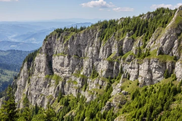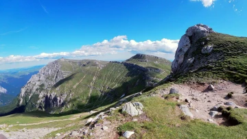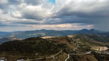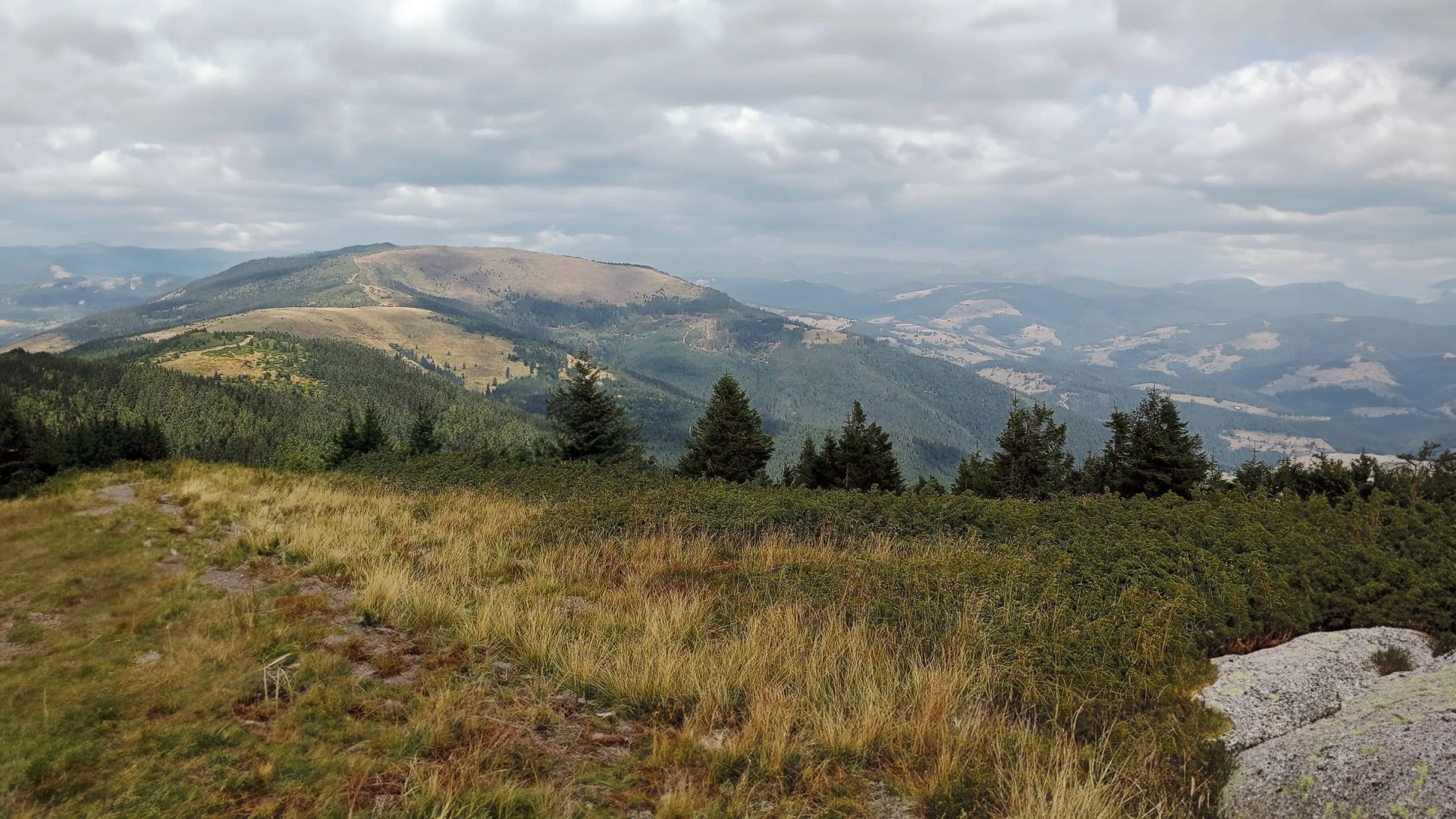
Bihor Peak, also known as Curcubăta Mare, is the highest peak in the Apuseni Mountains, in the Western Carpathians, Romania.
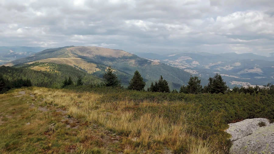
Bihor Peak landscape
In this article:
Thanks to its spectacular views, it attracts both nature-loving tourists and climbers eager for adventure.
Altitude: Bihor Peak rises to 1,849 meters, making it the highest point in the Apuseni Mountains.
See also Romania's highest mountain peak – Moldoveanu Peak.
Why Curcubăta Mare?
Bihor Peak has long been known to locals, but it has become more popular with tourists in recent decades. Its name comes from the county where it is located or from the massif of the same name.
Alternative name – Curcubăta Mare: It comes from its semicircular shape, resembling a pumpkin (curcubătă). See more here
Access and Location
Location: Bihor Peak is located in Bihor County, in the northwestern part of the country. It is part of the Bihor Massif (known for its picturesque landscapes and rich biodiversity) in the Apuseni Mountains.
Bihor Peak
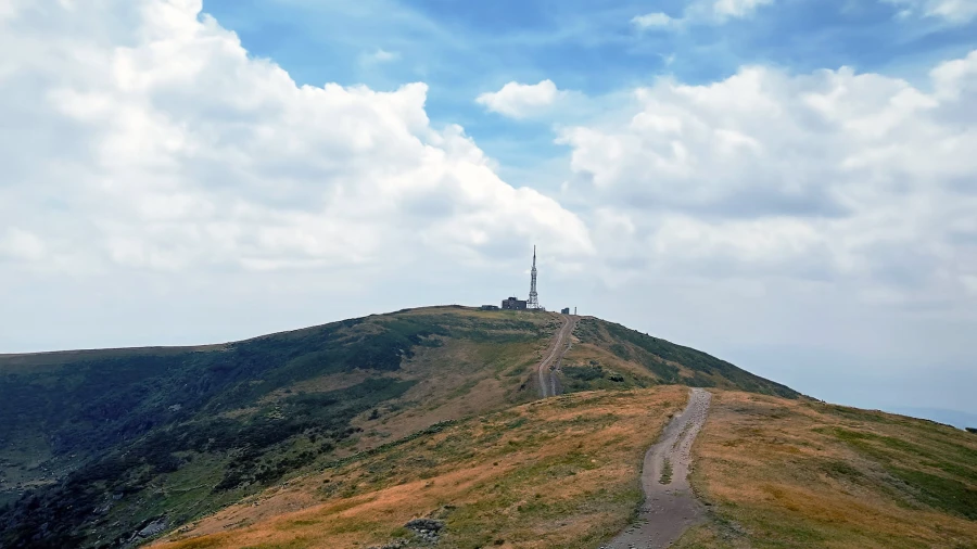
Access: It lies near Stâna de Vale, Vârtop and Arieșeni. The peak can be reached from these areas. Here are some details:
From Vârtop:
From DN75, whether you are coming from Alba Iulia or Oradea.
This route gives you an impressive view of the Apuseni Mountains.
The route can be done on foot or by bike, although in places you will have to push the bike.
From Arieșeni:
From DN75, coming from Arieșeni, in the village of Galbena, turn left into the Cepelor Valley.
The route can be done on foot or by car.
After a while, the forest road forks: to the left toward Pătrăhăițești tourist village and Pătrăhăițești Waterfall (also called Buciniș), while to the right it continues toward Bihor Peak for another 10 km.
On foot: A trail marked with a blue stripe leads to the peak. It takes about 3-4 hours.
By car: You can reach the peak on a gravel forest road. The drive takes about 40 minutes. If you choose to drive, it's best to have a car with high ground clearance, as the forest road can be rough.
Scenery and Views: From the peak, a superb panorama opens up over the surrounding valleys, forests and ridges: the Gilău, Muntele Mare, Vlădeasa, Trăscău and Metaliferi mountains. Visitors can admire the forested ridges and the rivers stretching into the distance. There is also a telecommunications and TV relay station here.
Geography and Geology
The mountain area of Bihor Peak, also known as Curcubăta Mare, stands out for its geomorphological diversity and its varied flora and fauna. The region is home to spectacular landscapes, unique geological formations and rich biodiversity.
Curcubăta Mare Peak
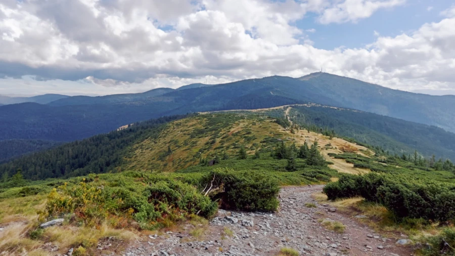
The terrain of the area is characterized by imposing mountain massifs, sculpted over time by the forces of nature. Bihor Peak stands out as the highest point in the area, offering stunning panoramas of the surroundings.
Alongside it, the Bihor Massif features peaks such as Găina Peak (1,486 m), Vlădeasa Peak (1,836 m) and Muntele Mare Peak (1,826 m), which complete the spectacular mountain picture.
Deep in the heart of Romania, the Apuseni Mountains hide a unique natural treasure: a spectacular triangle formed by their three highest massifs – Bihor, Vlădeasa and Muntele Mare.
The mountain landscape unfolds like a grand painting, and on clear days you can clearly see the two neighboring peaks, as if they were within arm's reach.
The vegetation typical of the Bihor Peak mountain area consists of dense coniferous forests, mainly fir and spruce, as well as areas of beech and sessile oak. At lower altitudes, there are alpine meadows full of colorful flowers, providing an ideal habitat for a variety of plant species.
The wildlife of the area is just as rich and diverse, including mammals such as the brown bear, wolf, Carpathian red deer, lynx, otter and wildcat. Many bird species can be seen, including the golden eagle, the alpine rose and the capercaillie.
The geological formations typical of this mountain area are made up of igneous and metamorphic rocks millions of years old.
The massif consists mainly of granite and gneiss, hard and resistant rocks that shaped the area's rugged terrain. Numerous outcrops of limestone and dolomite can also be seen, which gave rise to spectacular caves and gorges.
The formation of Bihor Peak is the result of a complex process of tectonic uplift that took place about 80 million years ago.
The block of igneous and metamorphic rock that Bihor Peak belongs to was gradually uplifted and later sculpted by erosion and ice, creating today's landscape.
Trails in the Apuseni Mountains to Bihor Peak (Curcubăta Mare)
The trails below are a way to explore Curcubăta Mare Peak and other attractions in the Apuseni Mountains. They can be done in a day:
1. Arieșeni – Bihor Peak
It starts in Arieșeni, like the trail to Vârciorog Waterfall. The elevation gain from the center of the resort is 900 m.
Difficulty: Moderate.
Total distance: 18 km
Estimated time: About 3-4 h for the ascent.
Trail markings: The trail is marked, but it is a good idea to have a map or go with a guide.
Notes: The hike takes you through alpine meadows where, in summer, you will come across herds of horses brought up to graze by the Moți, and you will find viewpoints overlooking the surrounding valleys and ridges.
2. Arieșeni – Curcubăta Mare Peak – Curcubăta Mică Peak – Arieșeni
Distance: 18 km
Difficulty: Moderate
Duration: 8-10 hours
The trail offers a spectacular ascent to the highest peak in the Apuseni Mountains, with an amazing panorama over the range.
It starts in Arieșeni, climbs through fir and spruce forests, then continues toward Bihor Peak. From the peak, you descend toward Curcubăta Mică Peak (1,769 m), from where you return to Arieșeni.
Recommendations:
The trail is recommended for hikers in good physical shape, with proper gear and mountain hiking experience.
It is important to check the weather forecast before setting out and to gear up accordingly.
There are no water sources along the trail (only at the weather station on the peak), so make sure you bring enough supplies.
3. Arieșeni – Vârciorog Waterfall – Piatra Grăitoare Peak – Curcubăta Mare Peak – Curcubăta Mică Peak – Pătrăhăițești Waterfall (Buciniș) – Pătrăhăițești Museum – Arieșeni
Distance: 25 km
Difficulty: Hard
Duration: 12-14 hours
Description:
This trail is longer and more difficult than the first one, but it offers a greater variety of attractions, including Vârciorog Waterfall, Piatra Grăitoare Peak, Bihor Peak (Curcubăta Mare), Curcubăta Mică Peak, Pătrăhăițești Waterfall and the Pătrăhăițești Museum. The trail starts in Arieșeni, climbs to Vârciorog Waterfall, continues toward Piatra Grăitoare Peak, then climbs to Bihor Peak. From here, you descend toward Curcubăta Mică Peak, then on to Pătrăhăițești Waterfall and the Pătrăhăițești Museum, from where you return to Arieșeni.
Recommendations:
The trail is recommended only for hikers in excellent physical shape, with proper gear and extensive mountain hiking experience.
It is important to check the weather forecast carefully and to gear up accordingly, as the trail includes difficult sections exposed to extreme weather.
4. Arieșeni – Piatra Grăitoare Chairlift – Cornul Berbecului Peak – Piatra Grăitoare Peak – Curcubăta Mare Peak – Arieșeni
Distance: 12 km
Difficulty: Moderate
Duration: 6-8 hours
This is an easier way to climb the peak, with the help of the Piatra Grăitoare chairlift. The route starts in Arieșeni and goes up by chairlift to the top station, at an altitude of 1,445 meters.
From the top station, the trail continues along the mountain ridge, passing Cornul Berbecului Peak and Piatra Grăitoare Peak, up to Curcubăta Mare Peak. From here, you descend on the same route to the chairlift's top station, then ride the chairlift down to Arieșeni.
This trail is an excellent option for hikers who want to climb the peak on a moderate route and enjoy spectacular views all along the way.
Recommendations:
The trail is recommended for hikers of average fitness, with proper gear and mountain hiking experience.
It is important to check the operating hours of the Piatra Grăitoare chairlift before setting out.
You can enjoy spectacular views all along the trail, including the panorama of the Apuseni Mountains, the fir and spruce forests and the unique mountain formations.
Advantages of this route:
An easier climb to Bihor Peak thanks to the chairlift
Spectacular views all along the trail
A shorter route than the other two options
An extensive route to Bihor Peak (Curcubăta Mare) from Stâna de Vale is described here; it follows the red stripe markings:
Stâna de Vale – Bohodei Saddle – Fântâna Rece: Set off from Stâna de Vale and follow the markings. The trail starts climbing through the forest, and after about an hour you will reach Bohodei Saddle. Continue toward Fântâna Rece.
Cârligatele Ridge – Cumpănățelul Saddle – Piatra Arsă: On the Cârligatele ridge, you will have a panoramic view of the valleys and forests. Descend to Cumpănățelul Saddle and continue toward Piatra Arsă, an interesting rock formation.
Vărășoaia Glade – Vărășoaia Chalet – Padiș Plateau: From Vărășoaia Glade, you will have an open view toward the Padiș plain. Continue to Vărășoaia Chalet, where you can rest and have a meal. From here, descend to the Padiș Plateau, an area of alpine meadows.
Bălileasa Depression – Glăvoi Glade – “La Grajduri” campsite – Căput Glade – Barsa Cohanului – Ponița Saddle – Vârtop Peak – Vârtop Saddle (Pensiunea Alpin) – Piatra Grăitoare Peak – Tarnița Bihorului Saddle – Curcubăta Mare Peak (Bihorul): This section takes you through various glades and ridges, offering a variety of landscapes. Finally, you reach Bihor Peak (Curcubăta Mare), where you will be rewarded with impressive views.
The route has a total length of 39.5 km and is recommended especially in summer. The estimated time to hike it one way is 12-13 hours.
Attractions in the Area
The Bihor Peak mountain area is home to a wealth of attractions worth visiting. From spectacular caves and picturesque waterfalls to nature reserves and historical monuments, this region offers something for every taste.
The main attractions in the area include:
Pătrăhăițești Waterfall (Buciniș)
Pătrăhăițești Waterfall, also known as Buciniș Waterfall, is located in the Bihor Mountains, below Curcubăta Mică Peak. It is about 14 meters high and falls in two tiers.
Bears' Cave
Located at the foot of Bihor Peak, Bears' Cave is one of the most important caves in Romania. Numerous prehistoric remains have been discovered here, including bear bones, rock carvings and wall paintings. The cave is open to visitors all year round and offers a fascinating guided tour.
Vârciorog Waterfall
Vârciorog Waterfall
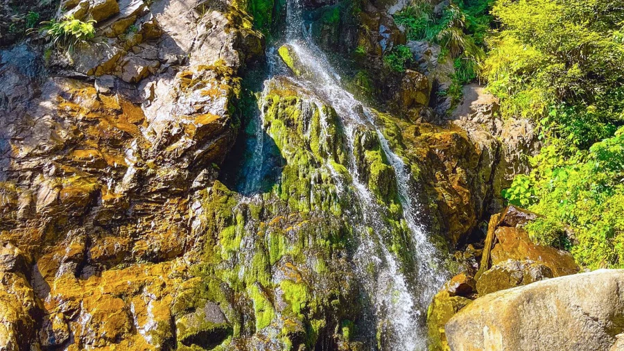
Vârciorog Waterfall is located in the Vârciorog Nature Reserve, is 15 meters high and offers picturesque scenery. Visitors can admire the waterfall from a designated viewpoint or hike through the reserve to discover the area's rich flora and fauna.
Scărișoara Nature Reserve
Scărișoara Cave entrance
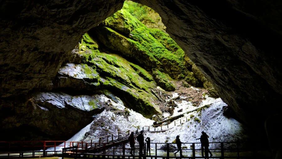
This reserve is home to Scărișoara Ice Cave, with an underground glacier unique in Europe. Visitors can descend into the cave to admire the spectacular ice formations and learn more about the glacial phenomenon.
Arieșeni Resort
Fir forest in Arieșeni
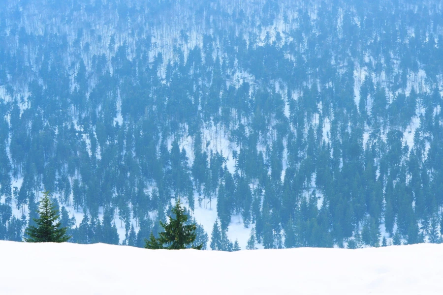
Arieșeni is a mountain resort located on the border between Alba and Bihor counties. It is the main starting point for tourists who want to discover the area.
Vârtop Ice Cave
Also known as the Wonderful Cave (Peștera Minunată) or the Casa de Piatră Ice Cave, this cave is located in the Bihor Mountains, near the commune of Arieșeni, Alba County.
This is where the oldest trace of Neanderthal man in Romania was found.
Groapa Ruginoasă
Groapa Ruginoasă
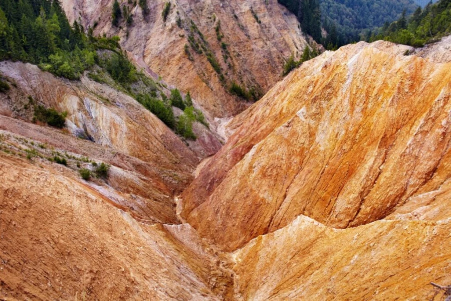
Located at an altitude of 1,400 meters, Groapa Ruginoasă is a valley with steep slopes, formed by torrential erosion (gullying). The layer of quartzite (reddish-purple in color) gives the area a distinctive look.
Găina Peak
Located in the Găina Massif, Găina Peak is the highest peak of this massif, at an altitude of 1,486 meters.
Curcubăta Mică Peak (1,769 m)
This peak has an altitude of 1,769 meters and lies about 3 km from Curcubăta Mare Peak (Bihor Peak).
From here you will have a spectacular view toward Țara Moților, with houses scattered across the mountain glades, and a panorama over the Arieșul Mare and Arieșul Mic valleys.
Near the peak there are five 105 m wind turbines, part of a wind farm in the area.
How to reach the attractions:
Most attractions in the Bihor Peak area can be reached on paved or forest roads.
Some attractions, such as Bears' Cave and Scărișoara Ice Cave, can only be reached on foot, by mountain hiking.
You can rent bikes or jeeps to explore the area more easily.
Visiting options:
Most attractions in the Bihor Peak area have set opening hours and an admission fee.
It is a good idea to check opening hours and admission fees before your visit.
Some attractions, such as Bears' Cave and Scărișoara Ice Cave, can only be visited with a guide.
Recommended activities:
Mountain hiking: The Bihor Peak mountain area offers an extensive network of marked trails, suitable for all experience levels.
Mountaineering: Bihor Peak is a popular destination for mountaineers, with routes of varying difficulty.
Caving: In the Bihor Peak area, you can explore numerous caves and potholes with a specialized guide.
Mountain biking: There are a number of mountain bike trails in the area that let visitors explore the spectacular mountain scenery.
Nature watching: The Bihor Peak mountain area is home to a rich diversity of plants and animals, offering excellent opportunities for nature watching.
Bihor Peak and its surroundings offer a wealth of options for mountain and nature lovers. You can also visit Tăul Mare Lake and Peak and the Pătrăhăițești Museum. The diverse attractions, varied activities and beautiful, spectacular scenery make this region an ideal destination for a memorable vacation.
Accommodation and Facilities in the Area
Some examples of accommodation and facilities in the Bihor Peak area:
Stâna de Vale: You'll find comfortable guesthouses and villas, ideal for a relaxing stay in the middle of nature. For example, Vila Izvorul Minunilor offers comfortable rooms and barbecue facilities.
Vârtop: If you prefer a more modern atmosphere, you can choose Hotel Arieș Vârtop. It has elegant rooms and a restaurant serving delicious food.
Arieșeni: Here, SKY HUB is an option with very good reviews. The mountain view is dreamy. You can also explore Scărișoara Cave, which is a short drive away.
These are just a few examples, and the area has many other accommodation options and interesting activities. If you need more information or other recommendations, visit Booking.com
Weather
The weather now and for the next 7 days in Arieșeni, Alba County:
Useful Information
If you are a beginner or don't feel comfortable going on your own, you can hire a local guide. Guides know the trails and can tell you about the area's flora and fauna.
Make sure you are properly equipped: hiking boots, suitable clothing, water, maps, a flashlight and food supplies.
From Bihor Peak, you will be rewarded with a spectacular view over the Apuseni Mountains. Alpine meadows stretch to the horizon, and forested ridges fade into the distance. On clear days, you can even see other nearby peaks.
Frequently Asked Questions
What is the highest mountain peak in the Apuseni Mountains?
The highest mountain peak in the Apuseni Mountains is Bihor Peak, also called Curcubăta Mare, at an altitude of 1,849 m.
Can you drive to Bihor Peak (Curcubăta Mare)?
You can drive to Bihor Peak (Curcubăta Mare) on a forest road, but a high-clearance vehicle is recommended.
Conclusion
Bihor Peak (Curcubăta Mare) is a natural treasure worth exploring. Whether you love hiking or just want to admire the beauty of nature, this peak will win your heart.
So grab your boots and venture into this wonderful part of the Apuseni Mountains in the Western Carpathians! Don't miss the resorts of Arieșeni and Stâna de Vale!
Set out to explore Romania's mountain peaks: Omu Peak, Toaca Peak, Parângul Mare Peak, Păpușa Peak.