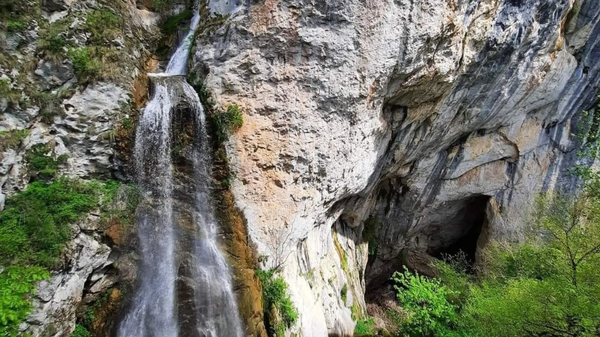
Vânătările Ponorului, also known as the Vânătările Ponorului Reserve, are an impressive and complex exokarst landform in the Apuseni Mountains.
This protected nature reserve is a point of interest in the Trascău Mountains, Alba County, and a remarkable example of how water shapes limestone terrain.
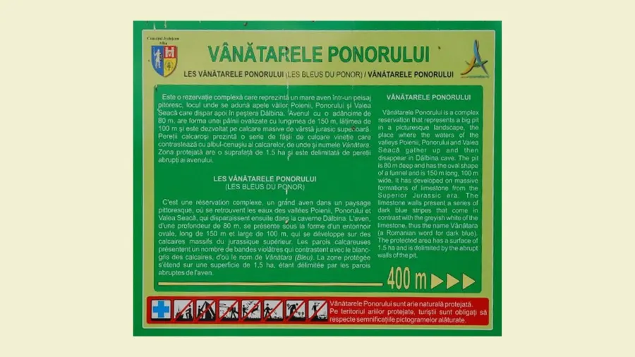
Vânătările Ponorului information board
Location and Access to the Vânătările Ponorului Reserve in the Trascău Mountains
The reserve lies in the southwestern part of the Bedeleu limestone ridge, part of the Trascău Mountains.
Geographically, it sits at the confluence of three important valleys: Valea Poienii, Valea Ponorului and Valea Seacă.
Administratively, the reserve's territory is divided between the village of Vale în Jos (Ponor commune) and the village of Dumești (Sălciua commune), in Alba County, and it covers an area of 5 hectares.
Ponor
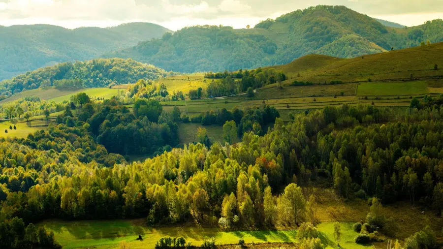
Another landmark in the area is the village of Sub Piatră, close by to the north. About 4 km to the south lies the village of Brădești (Râmeț commune), through which the Transapuseana passes.
If you're driving the Transapuseana, the turnoff to the reserve is at Brădești, where communal road DC104 heads north along Valea Poienii for about 6 km, up to a point above the reserve.
Valea Ponorului
Main Access Routes to Vânătările Ponorului
The main access to the protected area is from the village of Sălciua de Jos, on national road DN75, which runs through the Arieș Valley.
From Sălciua de Jos, the new road through the village of Dumești climbs about 6 kilometers onto the Bedeleu Plateau, to the northern edge of the reserve. From there, a trail marked with a blue stripe, about 800 meters long, descends to the rim of the impressive sinkhole.
Very close by, in Sub Piatră, is Huda lui Papară Cave, and a little farther away (25–50 km by road) are the Pociovaliștea Gorges and the Plai Gorges.
Another option is the Transapuseana (DJ107I), from Aiud through Râmeț to Brădești, then communal road DC104 along Valea Poienii toward Vale în Jos.
Connection with the Transapuseana Road (DJ107I)
The reserve does not lie directly on the route of the Transapuseana (DJ107I).
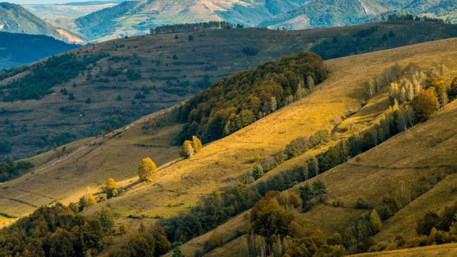
Transapuseana landscape
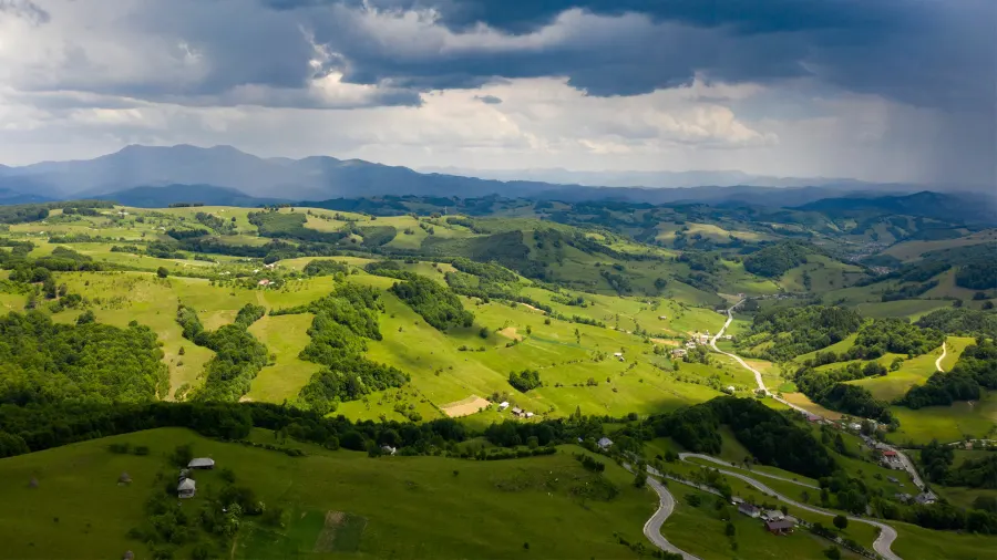
The Transapuseana road crosses the Trascău Mountains in a general east–west direction, linking the Aiud Valley (Aiud, Râmeț area) with the Metaliferi Mountains (Bucium, Abrud area), passing south of the massif where the protected area lies, through Brădești, about 4 km from the reserve.
As mentioned, the main access to Vânătările Ponorului is from DN75, at Sălciua.
Still, a visit here can be part of a broader tourist loop that also includes the Transapuseana: from it, you can make a detour at Brădești on DC104, or you can descend into the Arieș Valley on DN75 to Sălciua.
The connecting distances between the Transapuseana and DN75 (Sălciua) require planning. The Transapuseana itself is a spectacular road, giving access to other major sights in the Trascău Mountains and the Metaliferi Mountains, such as the Detunata Peaks, the Râmeț Gorges, the Vălișoara Gorges, Colțești Fortress, Râmeț Monastery or Piatra Cetii.
Detunata Goală
Description of the Vânătările Ponorului Reserve: The Polje and the Waterfall
The central feature of the reserve is an oval sinkhole more than 150 meters long, about 100 meters wide and about 80 meters deep, at the end of a vast closed depression that speleologists describe as a polje. Its steep walls were formed by collapses, and the waters disappear underground here. See Wikipedia
The Vânătările Ponorului Sinkhole – An Impressive Polje
Here the waters of three streams come together – Valea Ponorului, Valea Seacă and Valea Poienii: the first two join about 200 meters before the point where they disappear, while Valea Poienii plunges over the limestone wall in a waterfall about 25 meters high. This landform of the polje type is typical of heavily karstified limestone areas.
Vânătările Ponorului Waterfall and the Ponor Water System
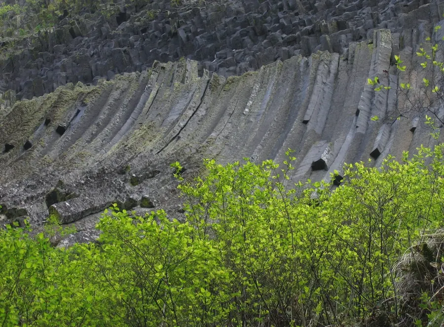
The most spectacular waterfall is Vânătările Ponorului Waterfall (also called Dâlbina Waterfall). This impressive cascade forms on a huge limestone wall, on which rainwater has left bluish-purple streaks that contrast with the grayish white of the rock and gave the place its name (“vânăt” means dark blue, purplish).
Vânătările Ponorului rock wall
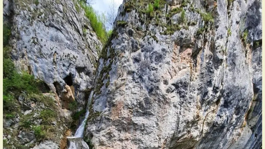
After the waterfall, all these waters disappear underground into a ponor at the foot of the wall, right below the mouth of Dâlbina Cave (sometimes also spelled Dalbina).
The Dâlbina Cave is a dry fossil cave, with its entrance a few meters above the point where the waters disappear, and the nearby waterfall is sometimes called Dâlbina Waterfall.
During periods of high flow, at the bottom of the sinkhole, especially when the ponor gets clogged with wood or hay, a temporary lake can form.
A karst spring can be associated with such karst systems, but in the case of Vânătările Ponorului, the focus is on water disappearing underground. The geology is dominated by massive Jurassic limestones.
Accommodation
To visit the natural monument, you'll find accommodation in the picturesque villages nearby.
In Poșaga commune, 13–20 km away by road, in the villages of Poșaga de Jos and Poșaga de Sus, you'll find rural B&Bs and guesthouses.
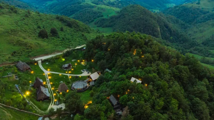
Closer by are the options in Sălciua commune: the Raven’s Nest holiday village on the Bedeleu Plateau, less than 1 km from the reserve, and the guesthouses in Sub Piatră, about a 40-minute walk away. Sălciua is a good base, with access to the Arieș Valley.
Raven’s Nest
About an hour's drive away, Rimetea offers a wide range of accommodation options for every taste.
Weather
Weather in Ponor commune, Alba County, now and for the next 7 days:
Explorations and Speleological Importance
The Vânătările Ponorului area has been extensively explored from a speleological point of view.
Exploring the Area as a Visitor
Most visitors admire the sinkhole and the waterfall from the wooden viewing balcony that Salvamont rescuers built on the rim, with a view of the grandeur of this polje and of the falling water of Vânătările Ponorului Waterfall. The descent to the bottom of the sinkhole is along a steep, slippery slope, with no marked trail.
The Speleological Importance of Dâlbina Cave Within the Ponor Reserve
The Dâlbina Cave is a small cave (about 60 meters, a single large chamber with few formations), one of the caves of the Vânătările Ponorului karst system.
It's easy to visit with a flashlight: there is a step of about 2 meters at the entrance. Huda lui Papară Cave, on the other hand, can only be visited with a guide and a permit.
Vânătările Ponorului – Huda lui Papară Cave
There is a direct hydrological connection between the karst system at Vânătările Ponorului and Huda lui Papară Cave.
In essence, the waters that disappear underground at Vânătările Ponorului (in the ponor below Dâlbina Cave) continue their course underground and reemerge at the surface through Huda lui Papară Cave. The connection is known from speleological explorations and from the floods that come out through Huda lui Papară when the temporary lake suddenly drains.
Huda lui Papară Cave thus serves as the main discharge point (resurgence or karst spring) for the entire underground water system fed by the waters of Vânătările Ponorului: the water exits through the cave entrance at Sub Piatră and then flows, as Valea Morilor, toward the Arieș.
Conclusions
Vânătările Ponorului are a natural monument of scientific and scenic value, a place where the power of water and the particular features of limestone rock have created a landform unique in the landscape of the Trascău Mountains.
We invite you to explore this part of Transylvania!
See also Șipote Waterfall in the Apuseni Mountains.