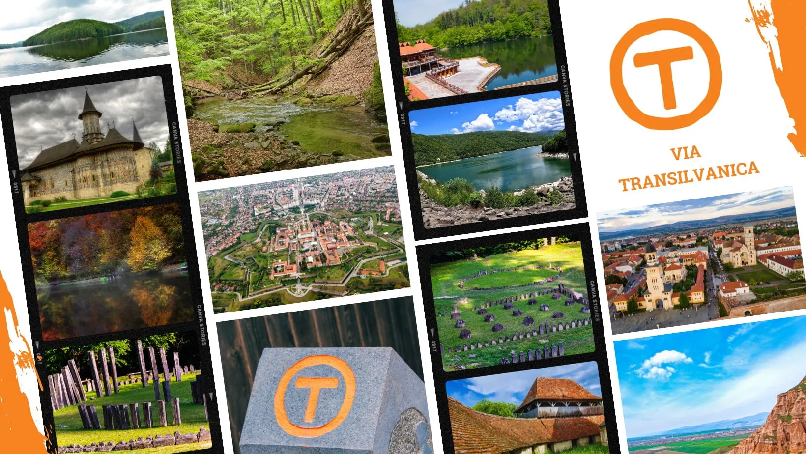
Via Transilvanica is a long-distance pilgrimage and hiking trail that crosses Romania, offering a unique experience for those who want to explore Romania's picturesque landscapes, culture, and national history.
Location and key facts about the trail
Trail length: Via Transilvanica is 1,420 kilometers long between Putna and Drobeta-Turnu Severin (about 1,600 km including the Terra Borza Teutonica branch, opened in 2025) and is meant for hiking, cycling, or horseback riding.
Location: “The Road That Unites” (Drumul care unește) starts at Putna Monastery and passes through 10 counties, more than 400 communities, and 12 UNESCO World Heritage Sites, before ending in Drobeta-Turnu Severin.
Recommended period: May–October.
The concept: Via Transilvanica is inspired by the concept of the Way of St. James (Camino de Santiago) in Spain, where pilgrims cover long distances to reach a sacred place. On Via Transilvanica, the pilgrimage unfolds in the heart of Transylvania, through villages, forests, mountain landscapes, and cultural and historical sites. (see the trail's official website https://www.viatransilvanica.com/)
Via Transilvanica's infrastructure gives hikers access to drinking water, accommodation, and meals.
The Via Transilvanica project: a brief history
The Via Transilvanica project was launched in 2018, the year that marked 100 years since the Great Union of the historical Romanian provinces into a single state, an event that took place in Alba Iulia Citadel.
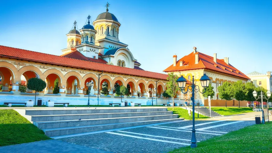
Reunification Cathedral in Alba Iulia
Via Transilvanica is a project initiated by the Tășuleasa Social Association, an NGO based at the Tihuța Pass, Bistrița-Năsăud County.
The project encourages people to explore and connect with the beauty of Romania, while also promoting the region's cultural and natural values.
The project grew out of two brothers' passion for hiking: Tibi Ușeriu, a well-known ultramarathon runner, and his brother, Alin Ușeriu. In 2022, the two went on to cover the entire trail, from Putna Monastery to the Danube: Alin on foot and Tibi running.
The initiative answered the need for a national project truly focused on unity.
This is how the idea of the road that unites was born.
Via Transilvanica serves not only as a link between the ten counties it crosses, but also as a symbol of the ethnic, cultural, historical, and geographic diversity of Transylvania and of the whole country.
The initiative was launched in the square of Alba Iulia Citadel in June 2018, the Centenary year.
At the time, completing the project seemed a long-term undertaking.
It started with Bistrița-Năsăud County, where the first roughly 140 km were inaugurated in 2018. In 2019, work was already underway on the two ends of the trail, namely the counties of Suceava and Mehedinți. Then came Brașov.
In 2020, work continued in the counties of Mureș, Harghita, and Sibiu, and in 2021, with the 250 km in Caraș-Severin County (the longest section of the trail).
In 2022, it was the turn of the last two remaining counties, Hunedoara and Alba.
Over four and a half years, the project gathered many supporters and, most importantly, thousands of hikers.
And so, on October 8, 2022, the “people of the road” gathered again in the square of Alba Iulia Citadel, after four years of work to which more than 10,000 volunteers contributed, to inaugurate the Via Transilvanica trail, a 1,400-kilometer trail, in a celebration that became Via Transilvanica Day.
The VT route
The Via Transilvanica route is divided into 7 cultural and historical regions: Bukovina, Ținutul de Sus (the Upper Land), Terra Siculorum, Terra Saxonum, Terra Dacica, Terra Banatica, and Terra Romana. Since June 2025, an eighth region has been added, Terra Borza Teutonica, a 172 km branch in Brașov County that starts in Viscri.
1. Bukovina
The Bukovina region of the VT stretches over 136 kilometers and includes significant historical monuments.
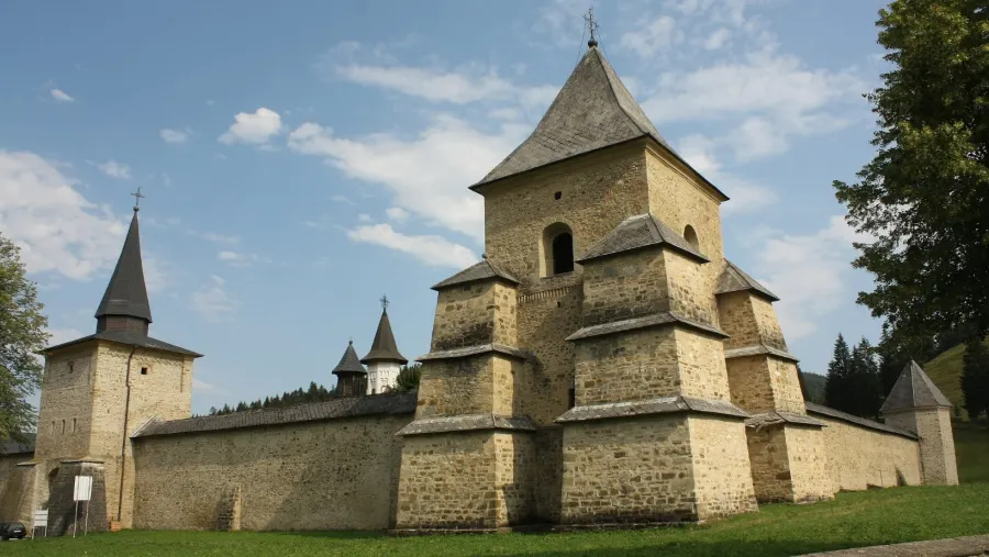
Sucevița Monastery 2
The route starts at Putna Monastery and heads toward the Sucevița Depression, passing through the village of Vatra Moldoviței and across the Obcinele Bucovinei ridges to the Mestecăniș Pass in Pojorâta commune. From here, it continues toward the Dorna Land (Țara Dornelor), through the Giumalău, Suhard, and Călimani Mountains.
From the Dorna Land (see Vatra Dornei), the traveler heads toward Poiana Negrii, with its wonderful springs, and stops at Poiana Stampei. This area is wild and the trail is difficult, especially through the mountain sections.
2. Ținutul de Sus
The Ținutul de Sus region of Via Transilvanica stretches over a distance of 277 kilometers. It crosses mountain areas, starting from Poiana Stampei, in Suceava County, and passing through the Tihuța Pass, in Bistrița-Năsăud County.
The route passes through Bistrița Bârgăului, then Petriș, Jeica, and Monor. From there, the trail heads toward Brâncoveni, crosses Casva and Brădețelu, and stops at Câmpu Cetății.
3. Terra Siculorum
The Terra Siculorum region is the third stage of the VT, and its name comes from the Latin name for Székely Land.
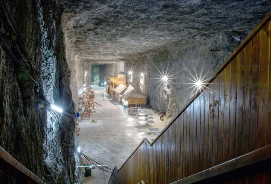
It stretches over 157 kilometers and starts at Câmpu Cetății, from where it crosses the Sovata-Praid Depression (see also the info on Praid Salt Mine) and the hills of Transylvania. From Odorheiu Secuiesc, it continues to Archita, on the border between Harghita and Mureș counties.
Terra Siculorum combines scenery with authentic Székely experiences, both cultural and culinary.
4. Terra Saxonum
From the land of the Székelys, you'll cross into that of the Saxons, on a new stage of the trail called Terra Saxonum.
Sighișoara Citadel
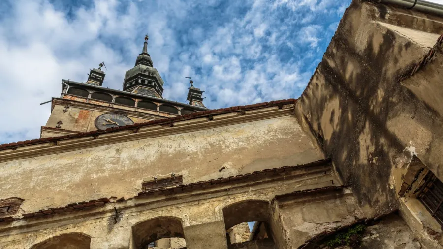
At 201 kilometers long, this section crosses the whole area once inhabited by the Saxons, starting from the Homorod Subcarpathians toward Saschiz, then on to Sighișoara and the Târnava Mare corridor. The route continues toward Mediaș – Copșa Mică – Micăsasa.
5. Terra Dacica
Terra Dacica is a history-laden section of the trail, its name celebrating the Daco-Roman heritage. It runs for about 290 kilometers and crosses the Blaj – Orăștie region. It also passes through Alba Iulia, the city of the Great Union.
The Route of the Three Fortifications, Alba Iulia
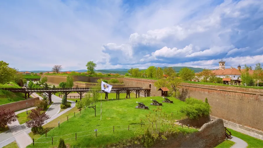
From Izvoarele, the trail leads to Aiud and then along the Mureș Valley, continuing toward the Vinț corridor – Geoagiu. This part of the trail goes as far as Orăștie and Sarmizegetusa.
6. Terra Banatica
The VT also crosses the mountainous area of Banat, over 232 kilometers. It starts at the Iron Gates of Transylvania, at the entrance to Caraș-Severin County, passes by Caransebeș, Reșița, and Prigor, through the Cornereva Depression, past the Cerna and Mehedinți Mountains, and reaches the Cerna Valley. From here, in the Terra Romana region, the trail runs through the Țesna Gorges – Bahna Valley – Topolnița Valley, all the way to Drobeta-Turnu Severin.
Terra Banatica is the ideal section of Via Transilvanica for cyclists.
7. Terra Romana
The last part of Via Transilvanica, known as Terra Romana, covers a distance of about 135 kilometers and passes through spectacular scenery. It starts in Crușovăț, Caraș-Severin County, and continues toward Mehedinți County.
The trail passes through Domogled National Park, as well as the Cerna Mountains, Herculane, and Obârșia Cloșani.
The Mehedinți Plateau is the last area the trail crosses before it ends in Drobeta-Turnu Severin.
Resources and useful information
The VT Hiker's Guide
The Hiker's Guide to Via Transilvanica is an essential resource for anyone who wants to explore the trail. It was written by Székely Anna, executive director of Tășuleasa Social, and her all-female team. Here are a few details:
Content: The guide offers general advice, detailed route descriptions, maps, elevation profiles, information about infrastructure (including accommodation), tourist attractions, and day-by-day descriptions of the trail.
Availability: It is available in five languages: Romanian, English, German, Hungarian, and Spanish. You can download it for free from the official website or buy it from the online store.
Purpose: The guide is not just a technical resource but also a “love letter” to this trail, encouraging the desire to explore and discover the beauty of Romania.
Via Transilvanica composition
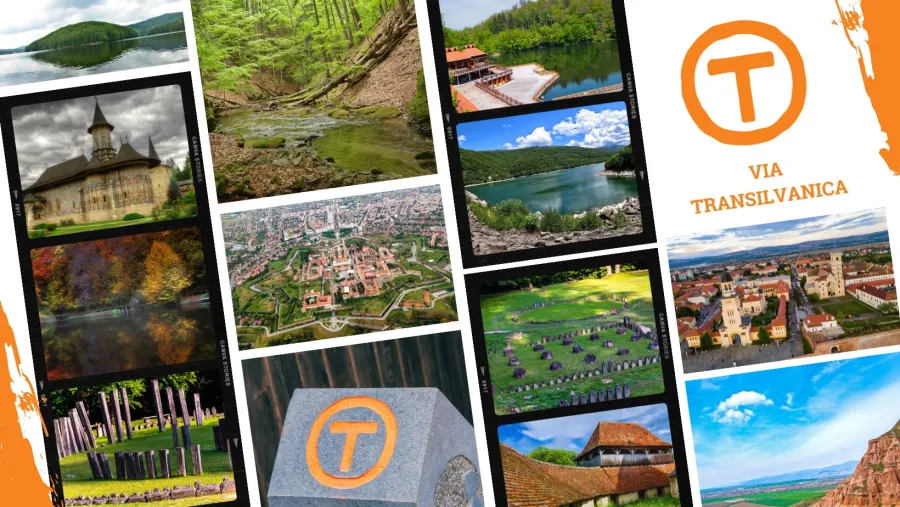
If you want to prepare for Via Transilvanica, also watch the short videos made by the VT team, which answer questions such as what to pack in your backpack or how to dress. Or check out the Cyclist's Guide if you plan to ride the trail by bike.
The Hiker's Notebook
It is an essential resource for those exploring the trail: a notebook where you write down memories and thoughts and collect the specially designed stamps at the end of each day described in the Guide. It is available in Romanian and English.
The VT milestones
The milestones along Via Transilvanica have a special story. At every kilometer, you'll come across one of these milestones made of andesite, carefully carved and unique, weighing about 260 kg.
Via Transilvanica sign
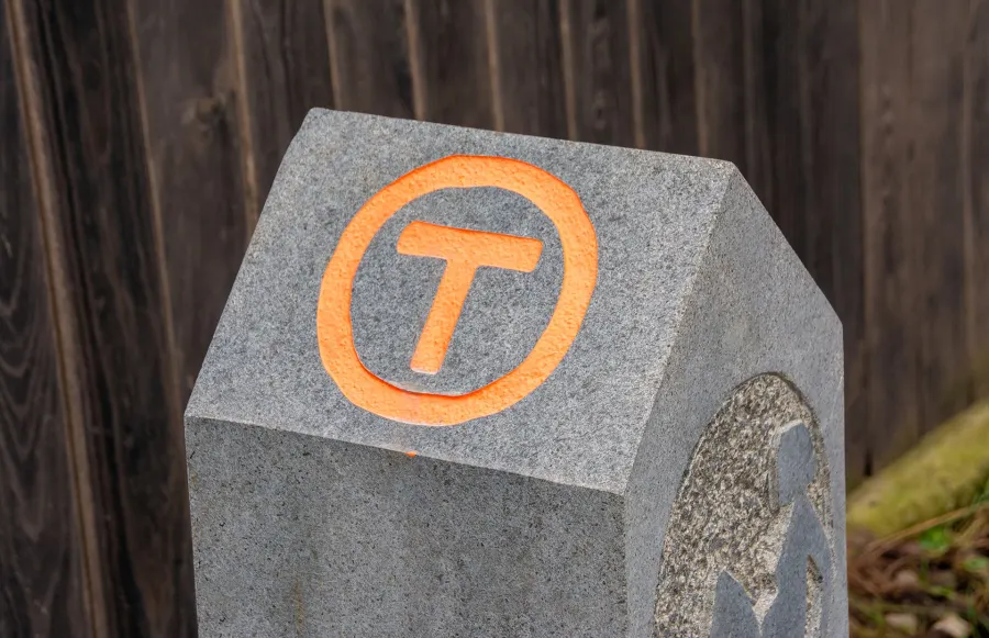
The Via Transilvanica milestones catch the eye immediately, decorated with the distinctive VT logo – an orange T in a circle of the same color.
The trail highlights the historical importance of every place it passes through, and each milestone is carved in its own way, reflecting the character of its area.
In addition, to make sure hikers don't get lost, Via Transilvanica is signposted at junctions and marked with painted waymarks all along the way.
Today, Via Transilvanica is fully set up, signposted, and marked with signboards, trail markings, and andesite milestones, each one a unique work of art. Thanks to the people who contributed milestones, to sponsors and partners, and to cooperation with local authorities, institutions, and organizations, Via Transilvanica has been completed.
830 km were funded through donations, sponsorships, and partnerships with various companies. See Wikipedia
The current challenge is maintaining and promoting the trail.
Via Transilvanica map
It covers all the regions of the trail, with their specific landmarks and sights. Each sector of the trail is divided into routes, and each route has its own Via Transilvanica trail map to help you find your way more easily.
Via Transilvanica map. Source: https://www.viatransilvanica.com/
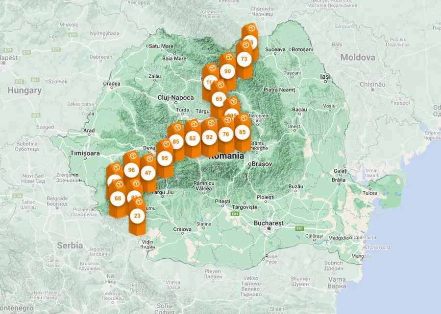
The map of each sector and route of Via Transilvanica is also included in the Hiker's Guide, described above.
Tourist attractions along Via Transilvanica
The counties crossed by Via Transilvanica are: Suceava, Bistrița-Năsăud, Mureș, Harghita, Brașov, Sibiu, Alba, Hunedoara, Caraș-Severin, and Mehedinți.
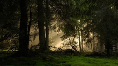
Sunrise in the forests of Bukovina
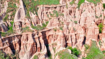
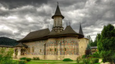
The trail also includes sites on the UNESCO World Heritage List, as well as other remarkable places. Here are a few examples:
Sucevița Monastery: A monument included on the list of UNESCO World Heritage Sites, famous for its exterior frescoes.
Teleki Castle in Posmuș: A historic building with impressive architecture.
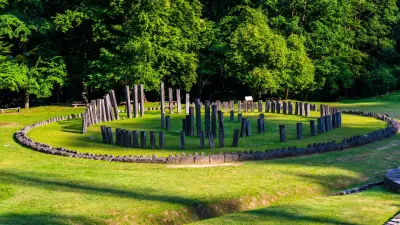
Ulpia Traiana Sarmizegetusa: A former capital of Roman Dacia, with ancient ruins and remains.
The dense forests of Bukovina: Spectacular natural landscapes and rich biodiversity.
Râpa Roșie near Sebeș: An impressive geological formation.
Poiana Mărului lake and meadow: A quiet area for relaxation and contemplation.
The Sequoia in the Semenic Mountains: A unique tree, 200 years old.
Inlăceni Village: With its Unitarian church and traditional atmosphere.
Abandoned and traditional villages: Such as Poiana Negrii and Obârșia Cloșani.
These attractions and UNESCO sites make Via Transilvanica a memorable journey through history, culture, and nature.
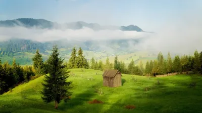
Sovata landscape
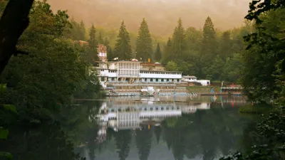
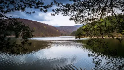
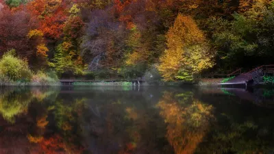
Along Via Transilvanica, hikers can come across a wide variety of cultural and natural attractions. Here are some of them:
Caraș Gorges (Cheile Carașului): Located in Caraș-Severin County, they offer impressive scenery, steep cliffs, and crystal-clear rivers.
Izvoarele Nerei UNESCO Reserve: A protected natural area where you can admire waterfalls, springs, and wild landscapes.
Comarnic Cave: A fascinating cave in Caraș-Severin County, in Semenic – Cheile Carașului National Park, with limestone formations and underground galleries.
The Croatian village of Carașova: A picturesque settlement with a traditional Croatian community, where you can discover the local culture and customs.
Poiana Mărului lake and meadow: A peaceful place to relax and admire the beauty of nature.
Gozna and Trei Ape Lakes: These reservoirs lie in the Semenic Mountains, in Caraș-Severin County, and offer an oasis of peace and beauty.
Bear Lake: It is the largest heliothermal lake in Europe, with very salty water.
Besides these, along Via Transilvanica you will come across a variety of historical and cultural buildings, including medieval fortresses, churches, monasteries, and traditional villages where you will have the chance to experience the local cuisine and hospitality.
Sighișoara Citadel
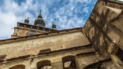
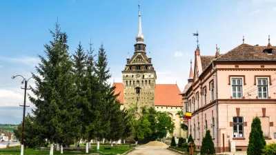
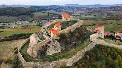
Here are a few notable examples of historical and cultural buildings:
Sighișoara Citadel: A well-preserved medieval citadel, a UNESCO World Heritage Site. Sighișoara is famous for its Clock Tower and its medieval atmosphere.
Rupea Fortress: Set on a rocky hill, Rupea Fortress offers impressive panoramic views of the surrounding area. It is one of the oldest fortresses in Transylvania.
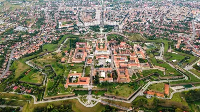
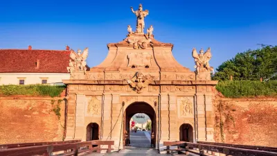
Alba Carolina Citadel: Located in Alba Iulia, it is a historical and architectural gem. It was built between 1714 and 1738 and designed as a modern, star-shaped fortification.
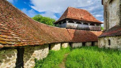
Viscri Fortified Church: An architectural gem, also a UNESCO World Heritage Site. The church in Viscri is known for its tall tower and for its role in the community.
Saschiz Fortified Church: Another notable fortified church, with a massive tower and typical Saxon architecture.
Cârța Monastery: A 13th-century Cistercian monastery set in a picturesque landscape. It is one of the oldest monasteries in Transylvania.
Traditional villages: Along the trail or close to it, you will find authentic villages such as Viscri, Biertan, Cincșor, Agnita, and many others. These villages preserve traditional Saxon architecture and offer a glimpse into rural life in Transylvania.
These buildings and places will take you back in time and reveal the cultural and historical richness of Romania.
Accommodation
Along Via Transilvanica, there is a variety of accommodation options. From rustic guesthouses in authentic villages to modern hotels in towns, every stage of the trail offers different possibilities. The Hiker's Guide provides information on accommodation along the trail. Here are a few types of accommodation you can find:
Guesthouses and B&Bs: These are the most common accommodation options on the trail. Guesthouses are run by locals and offer a welcoming atmosphere. Most include breakfast and have comfortable rooms. In many cases, you will have the chance to interact with your hosts and learn more about the area you are in.
Hotels and motels: In towns and larger localities, you will find hotels and motels. They offer more complete services, including a restaurant, room service, and other amenities. If you prefer modern comfort, this may be the right choice.
Chalets and mountain shelters: On wilder sections of the trail, you will come across chalets and mountain shelters. They are ideal for multi-day hikes and offer simple but authentic accommodation. Make sure you have a sleeping bag and other necessary gear.
Camping and tents: If you love camping, you can choose to pitch your tent in designated areas. Follow local rules and make sure you have the right gear.
Local hosts: Sometimes locals offer accommodation in their own homes. This can be a unique experience, where you will learn more about life and culture in the area.
Whatever your preferences, book your accommodation in advance, especially during the tourist season. You can also check specialized websites such as Booking.com
Weather
Pay attention to information about the best times of year and the right weather conditions for traveling the trail!
The weather at the starting point of the VT, Putna, today and for the next 7 days:
Useful tips for Via Transilvanica
If you want to explore Via Transilvanica, here are a few useful tips and resources in brief:
Gear: Make sure you have proper hiking gear, including comfortable footwear, clothing suited to the weather, and a lightweight backpack.
Planning: Study the trail in advance and plan your stages. Guides and maps are available online to help you find your way.
Accommodation and food: Check the accommodation and dining options along the trail. Some villages and towns have guesthouses or restaurants where you can rest and eat, and prices suit every budget.
Safety: Follow safety rules while hiking. Carry water, a first-aid kit, and information about emergency numbers.
Community: Connect with locals and other hikers. Via Transilvanica is also about human connections and sharing experiences.
Did you know?
In 2023, the project received the Europa Nostra Award in the “Citizens' Engagement & Awareness-raising” category, presented by Europa Nostra and the European Commission. At the awards ceremony, held in Venice on September 28, 2023, the project also received the Public Choice Award, following the votes of 27,000 citizens from Europe and other countries.
The documentary Oamenii Drumului: Terra Banatica (The People of the Road: Terra Banatica), directed by Mircea Gherase, shows how the VT was built in Caraș-Severin County and highlights the local people who are part of this story.
Via Transilvanica was included in TIME magazine's top 100 “World's Greatest Places to Visit in 2024.” See details.
Frequently Asked Questions
How long is Via Transilvanica?
Via Transilvanica has a total length of 1,420 kilometers. It crosses ten counties, starts at Putna Monastery, and the end of the trail is marked in Drobeta-Turnu Severin.
How long does it take to complete Via Transilvanica?
On foot, walking the entire trail takes about two months. Ultramarathon runner Tibi Ușeriu covered it running, in just over a month.
Can you ride Via Transilvanica by bike?
Via Transilvanica can be ridden by bike. Some sections are demanding, and we recommend reading the Cyclist's Guide, available on the trail's official website, before you set off.
What is the most difficult part of the trail?
Bukovina can be considered one of the most demanding sections of Via Transilvanica because of its large changes in elevation, but it is also among the most impressive.
Which other hiking trails intersect with Via Transilvanica?
Via Transilvanica shares sections with Via Mariae, also known as the Way of Mary (Drumul Mariei), a pilgrimage route that starts in Austria and reaches Șumuleu Ciuc, in Harghita County.
Conclusions
Via Transilvanica promotes diversity and unity.
Inspired by historical pilgrim routes and by hiking trails such as the Way of St. James and the Appalachian Trail, Via Transilvanica stands out for its biodiversity, the variety of its natural landscapes, and the rural heritage still preserved in Romania.
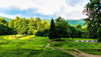
Sarmizegetusa landscape
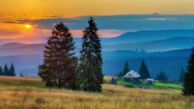
The trail is marked with painted waymarks and posts, and along the way you will discover medieval fortresses, churches, monasteries, and traditional villages.
Via Transilvanica is much more than a road; it is a journey through history, culture, and nature that will captivate and delight you at every stage.
For more information and details, visit the official Via Transilvanica website.
We invite you to explore the Transfăgărășan, the Transalpina, and the Transapuseana, other very well-known routes in Romania.